


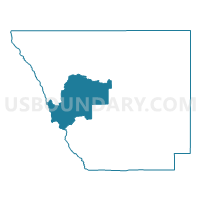
Larimer 405, Larimer County, Colorado
About
Outline

Summary
| Unique Area Identifier | 548812 |
| Name | Larimer 405 |
| County | Larimer County |
| State | Colorado |
| Area (square miles) | 249.07 |
| Land Area (square miles) | 247.42 |
| Water Area (square miles) | 1.64 |
| % of Land Area | 99.34 |
| % of Water Area | 0.66 |
| Latitude of the Internal Point | 40.64067100 |
| Longtitude of the Internal Point | -105.72400140 |
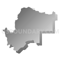
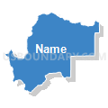
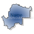
Maps


Graphs
Select a template below for downloading or customizing gragh for Larimer 405, Larimer County, Colorado


Neighbors
Neighoring Voting District (by Name) Neighboring Voting District on the Map
- Grand 1, Grand County, CO
- Jackson 5, Jackson County, CO
- Larimer 401, Larimer County, CO
- Larimer 402, Larimer County, CO
- Larimer 403, Larimer County, CO
- Larimer 406, Larimer County, CO
- Larimer 411, Larimer County, CO
Top 10 Neighboring County Subdivision (by Population) Neighboring County Subdivision on the Map
- Granby CCD, Grand County, CO (11,932)
- Estes Park CCD, Larimer County, CO (11,309)
- Livermore CCD, Larimer County, CO (5,069)
- Walden CCD, Jackson County, CO (1,394)
Top 10 Neighboring Unified School District (by Population) Neighboring Unified School District on the Map
- Poudre School District R-1, CO (184,648)
- East Grand School District 2, CO (11,977)
- Park School District R-3, CO (11,493)
- North Park School District R-1, CO (1,394)
Top 10 Neighboring State Legislative District Lower Chamber (by Population) Neighboring State Legislative District Lower Chamber on the Map
Top 10 Neighboring State Legislative District Upper Chamber (by Population) Neighboring State Legislative District Upper Chamber on the Map
- State Senate District 15, CO (155,929)
- State Senate District 8, CO (148,629)
- State Senate District 16, CO (136,132)
Top 10 Neighboring 111th Congressional District (by Population) Neighboring 111th Congressional District on the Map
- Congressional District 2, CO (733,805)
- Congressional District 4, CO (725,041)
- Congressional District 3, CO (706,186)
Top 10 Neighboring Census Tract (by Population) Neighboring Census Tract on the Map
- Census Tract 2.01, Grand County, CO (4,817)
- Census Tract 24.02, Larimer County, CO (2,963)
- Census Tract 9556, Jackson County, CO (1,394)
- Census Tract 28.03, Larimer County, CO (92)
Top 10 Neighboring 5-Digit ZIP Code Tabulation Area (by Population) Neighboring 5-Digit ZIP Code Tabulation Area on the Map
- 80517, CO (9,313)
- 80512, CO (2,185)
- 80447, CO (1,964)
- 80536, CO (1,759)
- 80480, CO (1,300)
- 80545, CO (851)
- 82063, CO (100)